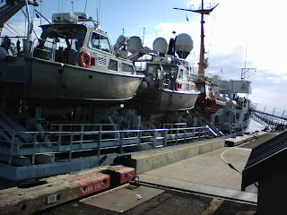
It started with an email. Someone I knew recommended asking me whether or not I'd like to take on a volunteer position helping the Olympic Coast National Marine Sanctuary map the sea floor off the coast of Cape Alava for two weeks. Apparently Katie B. suggested me to Nancy W. and I was invited to join a the NOAA vessel Fairweather and her crew and scientists on a sea floor mapping mission. Hmm, do something different for a change? Get out of an In-Law-festated house for a switch? I jumped ALL OVER IT!! How many opportunities like this can one expect in life?
My father was a 30-year Navy man but I was never really exposed to life aboard a ship at sea. My first vague memories on board a ship was coming back from Rota, Spain when I was around 4 years old. I'm sure it took some time crossing the Atlantic but I remember not being able to use the pool, 1) I didn't know how to swim and 2) there wasn't a wading pool for kids. When we arrived in New York Harbor, it was foggy and I couldn't really see much of the city, just vague forms of monolithic buildings disappearing into the grayness.
Other than that, I've toured a few Navy vessels on class trips and slept aboard my father's ship more than once or twice. Then there're the Seattle ferries which I love but that's different. The trip lasts less than an hour at most. I've been on a cruise ship for a few days. I've been on whale watching tour boat in heavy seas for a day. 'Been on various boat based fishing trips. Perhaps the most exciting ship board experience of my life has to be the Dependent's Day trip aboard the Nimitz. That was AWESOME. We sailed from Indian Island out to just off the coast of Sequim in the Strait of Juan de Fuca. The ship went operational with several key aircraft launching and landing to demonstrate operations while we stood on the deck and watched!
Well, this voyage might not have the excitement of listening to the afterburners of an F-14 Tomcat or F-18 Hornet taking off the flight deck while standing a mere few hundred feet away, but this has the makings of an epic journey into . . . boredom? Perhaps. But, I wouldn't miss it for the world! We'll be, how do you say, literally charting uncharted waters.
I'll be on a launch doing near shore surveys using multi-beam sonar and then downloading it and post-processing it. Yeah, that's the mundane stuff until you realize just how cool it'll be to have that data! It's like LiDaR (which is like radar) of an alien landscape. Think of the NASA stuff, you know, the maps of the surface of the moon and mars and such? Some of that's done using radar (radio waves). We do the upland earth in LiDaR (which uses laser light instead of radio waves). Now using sonar (which uses sound waves) we'll be mapping high resolution digital elevation models of the sea floor.
Folks like me are classified as visitors on board. We've been oriented on where to be when and how to don our "Gumby" suits (a.k.a., Mustang Survival Suit). So far, we've drilled for fire and for an abandon ship. Everything went smoothly. I believe this is quite old hat to the crew, which is good. Ya wanna crew that . . . knows what ta do in an emergency. The food is supreme! I'm planning on losing some weight for the coming Seattle to Portland ride come mid July. Mostly I figure I will since my carb intake will definitely go waaaay down (this is a no booze cruise). However, I must resist some of the delicious carbs being served at meal time. Last weight check: 206 lbs. We shall see in 14 days.

No comments:
Post a Comment